
Lidar Solutions for Digital Driven Construction
From site capture to coordination ready models deliver precision, speed, and clarity at every phase of your project.
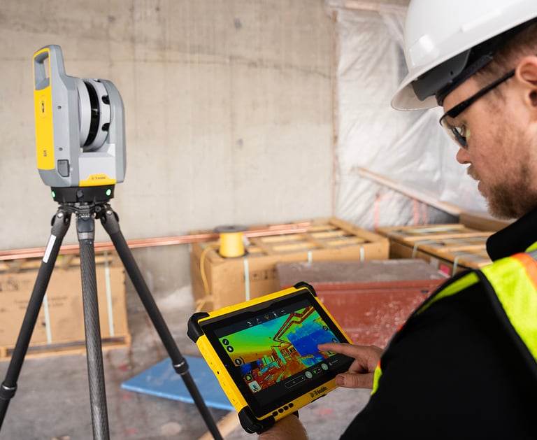
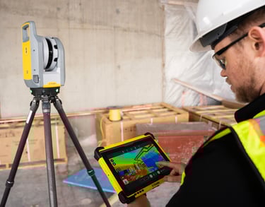
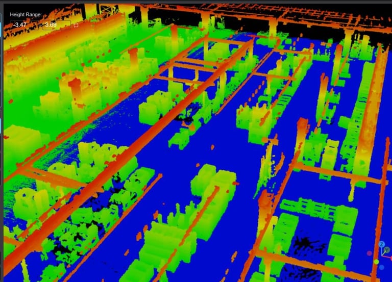
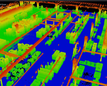
From Raw Reality to BIM-Ready Intelligence
All in One Place
We empower AEC teams with an integrated LiDAR workflow that streamlines field data capture and accelerates model deliverables, provide hardware, processing, modeling, and automation services, all designed for alignment with modern VDC, Design - Build, and IPD standards.
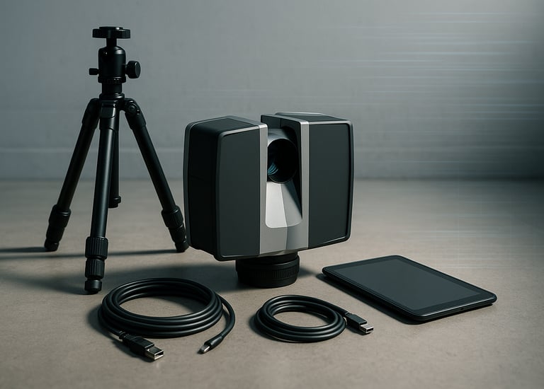
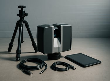
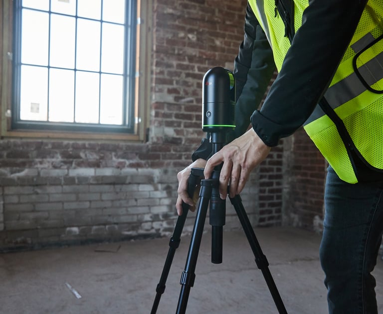
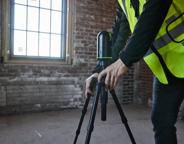
Professional Equipment Rental
Access industry-trusted scanners on flexible terms. Shipping nationwide with remote onboarding included.
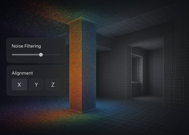
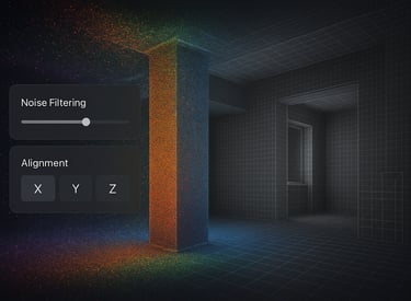
Point Cloud Structuring & QA
We process, classify, and clean raw scans to create structured datasets ready for coordination and modeling.
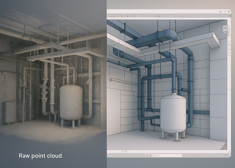

Scan to BIM
Conversion
Receive high-fidelity Revit models (LOD 300–400) optimized for architecture, MEP, and structural disciplines. Fully compatible with Revit, Navisworks, and IFC-based workflows.
AI-Augmented Modeling Automation
Leverage object recognition, prefab segmentation, and intelligent algorithms to reduce manual modeling time and increase consistency.
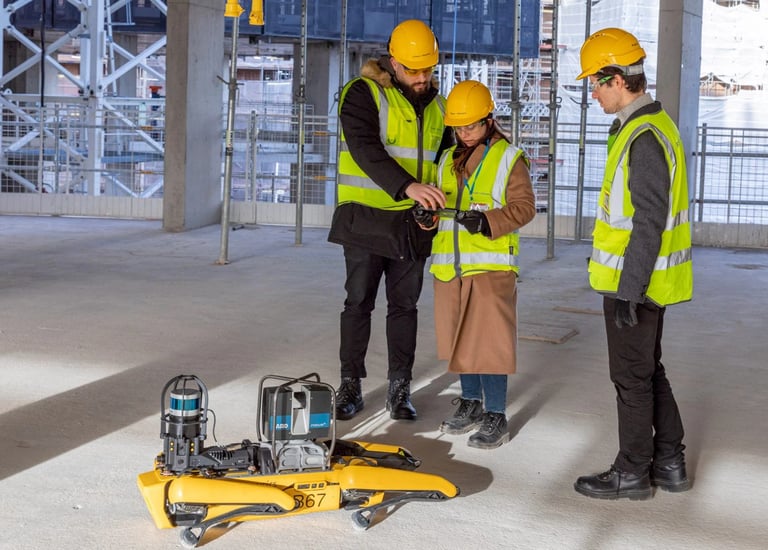
LiDAR Equipment for Professional-Grade Scanning
Explore our nationwide lineup construction grade devices available for weekly or monthly rental.
Trimble X7
Smart scanning with automatic calibration and seamless BIM workflows.
Trimble X7 is engineered for structural engineers and topographic surveyors needing robust field performance.
Key Specs:
Range: 80 meters
Accuracy: ±2 mm
Output formats: .tzf, .rcp
Best For:
Structural validation
Site grading and topo
Construction QA/QC
Leica BLK360
Compact, versatile, and field-ready.
The BLK360 G2 offers fast, high-resolution 3D laser scanning for indoor spaces and small-scale architectural projects.
Key Specs:
Range: Up to 45 meters
Accuracy: ±4 mm
Output formats: .e57, .rcp, .las
Best For:
As-built documentation
Interior scans
Architectural modeling
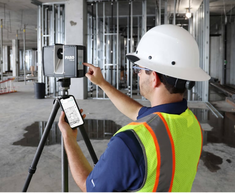
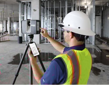
FARO Focus
High-performance scanning for industrial environments.
Capture precise detail in expansive or complex job sites with industry-grade accuracy and range.
Key Specs:
Range: Up to 350 meters
Accuracy: ±1 mm
Output formats: .fls, .e57, .xyz
Best For:
Range: Up to 350 meters
Accuracy: ±1 mm
Output formats: .fls, .e57, .xyz
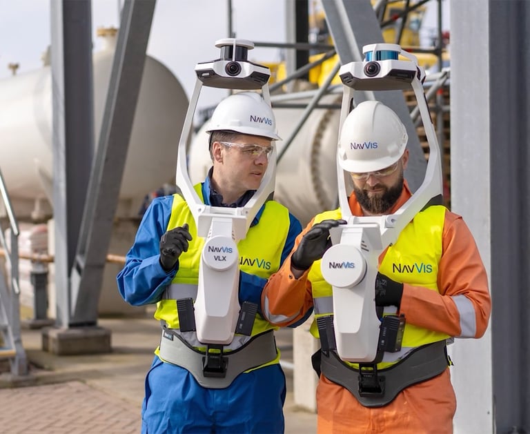
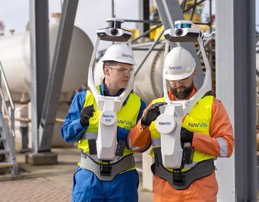
NavVis VLX 3
Mobile mapping meets intuitive 3D scanning.
Perfect for rapid indoor documentation, the VLX 3 combines visual SLAM technology with high-definition LiDAR.
Key Specs:
Range: 50 meters
Accuracy: ±8 mm
Output formats: .ply, .e57
Best For:
Office/commercial interiors
MEP coordination
Facility management documentation
Geospatial Solutions That Drive Results
Transform field data into reliable coordination assets that reduce rework, compress timelines, and support owner handover standards.
Asset & Progress Monitoring
Live visualization and geotagged tracking across job sites, facilities, and infrastructure corridors.
Digital QA/QC & Inspections
Clash-ready geometry and accurate measurements to ensure conformance and reduce change orders.
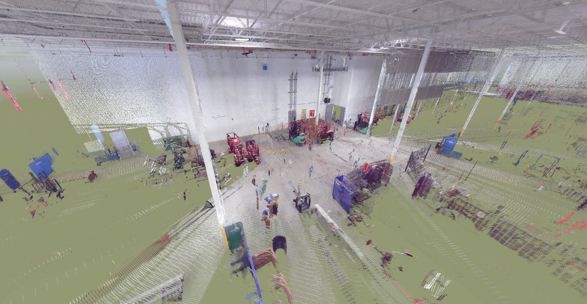
3D Mapping & Digital Twin Capture
High-resolution spatial datasets for site validation and model alignment.

Why Leading VDC Teams Trust BIM360 Tech
We embed into your process, not just your procurement.


Full-Service Rental, Coast to Coast
We support your team from Seattle to Miami, with logistics, training, and VDC & BIM support embedded in every project.
End to End Workflow Integration
We understand the full lifecycle: from field reality to cloud-based model federation.
Request a Demo or Proposal


Let’s talk about your next LiDAR-driven project.

Privacy | Do not sell or share my personal information | Cookie preferences | Report noncompliance |
Terms of use | Legal | © 2025 BIM360 TECH.
All rights reserved